Get3D Mapper-SAT: Satellite-Based 3D Construction Expert
Overview
Mapper-SAT is Get3D’s specialized platform for satellite-based 3D reconstruction. Designed to handle the unique characteristics of satellite imagery including large coverage areas, varying resolutions, and multi-source data integration, Mapper-SAT delivers consistent, production-ready 3D models at regional and national scales.
Functions
- Supports one-click import of massive same-orbit, cross-orbit, and multi-source satellite imagery
- Fully automated processing with output of 3D models, DOM, TDOM, DEM, DSM, building footprints, LOD1.3, and more
- Supports DOM/DEM-assisted bundle adjustment
- Supports automatic radiometric color balancing and vegetation enhancement
Application Highlights
- Provides foundational data for city-scale LOD1.3 3D models
- Enables large-scale realistic 3D reconstruction worldwide
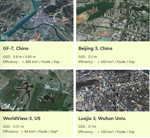
- Efficiency up to 600 km² per node per day
- Reconstructs an entire region-scale area in 6 days
Test Environment: CPU — Intel i7-9700K; GPU — NVIDIA GeForce GTX 2070; RAM — 64 GB
Supported Satellite Data
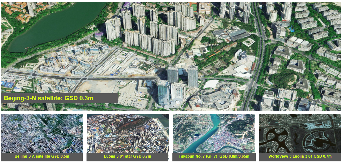
Get3D Mapper-SAT generates 3D mesh models from various satellite data, including Beijing-3-N, Beijing-3-A, Luojia-3 01, GF-7, and WorldView-3.
Key Advantages
3D Mesh Model from Various Satellite Data
Geometric Constraints Improve Quality and Efficiency 300%+
Get3D Mapper-SAT incorporates geometric constraints that improve reconstruction quality and efficiency by over 300%:
| Constraint | Purpose |
|---|---|
| Edge Constraint | Preserves building edges and structural boundaries |
| Water Constraint | Handles water surface reconstruction |
| Geometry Anomaly Detection | Identifies and corrects outlier geometry |
| Cloud Mask | Detects and excludes cloud-covered regions |
Video-to-3D Reconstruction
Get3D Mapper-SAT supports modeling using video from satellite. The workflow decomposes satellite video into frames and reconstructs 3D models from the resulting multi-view sequence.
Workflow: Video → Decompose → 3D Model
White-Frame Model Generation
| Stage | Time |
|---|---|
| Test Area | 130 km² |
| Processing Time | 16 h |
| Boundary Extraction | 64 min |
| White Frame Geometry | 3 h |
| Total | ~20 h |
Automatic Building Footprint Extraction and Completion
| Channel | IOU | Recall | Precision |
|---|---|---|---|
| RGB | 0.7516 | 0.9736 | 0.7672 |
| DSM | 0.7672 | 0.9796 | 0.7797 |
| RGB + DSM | 0.8891 | 0.9331 | 0.8260 |
Related Articles
- What Is Satellite Imagery 3D Reconstruction? — Principles of Satellite 3D Reconstruction
- Satellite Sources — Satellite data sources supported by Mapper-SAT
- Six Advantages of Get3D Mapper — Homologous Processing Platform for UAV-based Urban Modeling
- LOD Level of Detail Explained — The Conceptual Background of LOD in the LOD 1.3 Model
Source: Get3D Knowledge Center