What Hardware and Software Do You Need for Air-Ground Fusion?
Summary: Air-Ground Fusion requires coordinated aerial capture, ground-level scanning, automated data alignment, and scalable processing. Get3D covers all four stages without the integration overhead of mixing vendor tools.
Who This Guide Is For: Surveying professionals, 3D modeling teams, and project managers evaluating integrated vs. multi-vendor Air-Ground Fusion solutions.
The Get3D Ecosystem at a Glance
Air-Ground Fusion combines aerial and ground-level data to produce complete 3D models that neither source can achieve alone. But implementing it requires solving four practical challenges: capturing quality aerial imagery, scanning complex ground-level spaces, automatically aligning the two datasets, and processing the combined data at scale. Get3D has built an ecosystem of four components — each addressing one challenge — designed to work together without vendor-integration overhead:
- Get3D 5-in-1 Camera: High-performance oblique camera for drone-based aerial image capture
- Get3D R200 Scanner: Survey-grade SLAM laser scanner for ground-level capture
- Get3D Mapper: Powerful processing software with automated fusion capabilities
- Get3D Farm Lite: Portable cluster computing device for large-scale processing
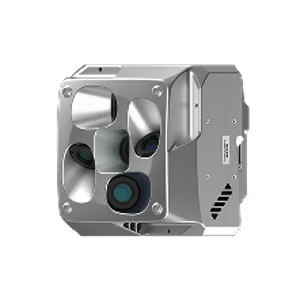
Get3D 5-in-1 Camera: Aerial Oblique Imaging System
The Get3D 5-in-1 Camera is a high-performance oblique camera system designed for drone-based aerial image acquisition. Mount it on a UAV to capture multi-angle, high-resolution imagery across large sites from the air, providing the essential aerial data foundation for Air-Ground Fusion workflows.
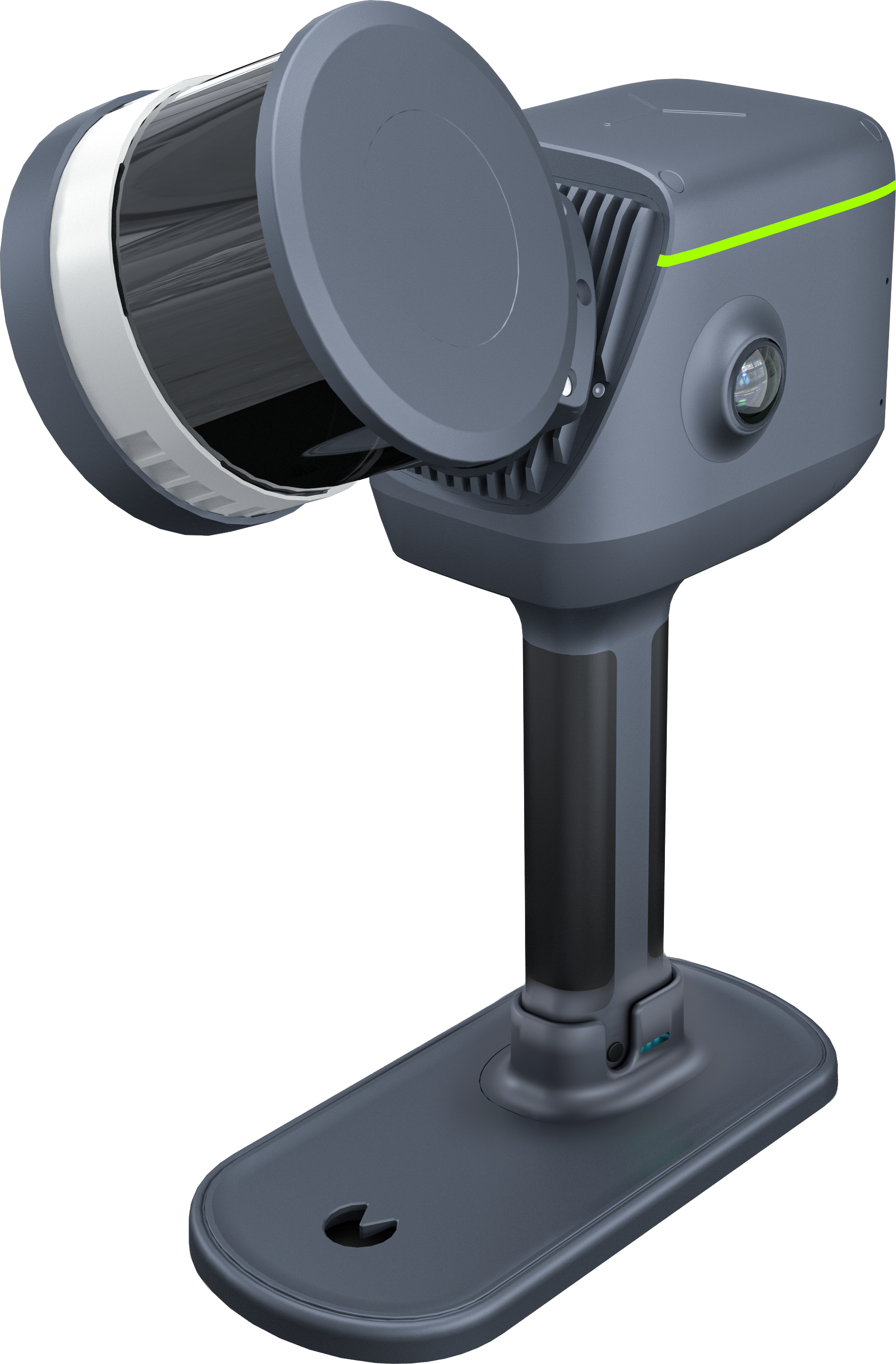
Get3D R200: The Ground-Level Workhorse
The R200 is a survey-grade SLAM laser scanner designed for flexibility and reliability in demanding environments.
1. All-in-One Design
- Built-in survey-grade antenna: stable positioning without external modules
- Dual 190° ultra-wide true-color cameras: capture more in one pass, fewer re-scans
- Integrated handle battery: quick swap, over 90 minutes per battery, ready for continuous field work
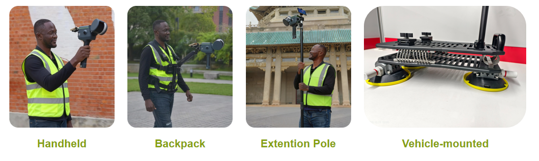
2. Multiple Mount Options
3. Real-Time Calculation
Visual feedback ensures complete scanning
4. Stable Fixed Solution
- Stable signals in obstructed environments
- Ensures survey-grade absolute coordinates
Get3D Mapper: The Brains Behind the Operation
Get3D Mapper is a software platform handling the complex processing that turns raw scan data into fused, usable models. Key capabilities include:
- Automated Aerial-Ground Fusion: The software automatically aligns aerial and ground datasets into a unified coordinate frame. No manual tie-point work, no stitching errors.
- AI-Powered Object Recognition: Intelligent algorithms can identify trees, buildings, roofs, and other objects, applying appropriate modeling strategies to each.
- Scalable Cluster Processing: When projects are large, Get3D Mapper can distribute processing across multiple computers simultaneously, dramatically reducing turnaround time.
Get3D Farm Lite: Portable Power for Large-Scale Projects
Farmlite is Get3D’s portable cluster computing solution that brings data center-level processing power to any site. This portable computing device can house multiple processing nodes.
The Complete Workflow
- Capture: Deploy drones loaded with Get3D 5-in-1 Camera to capture high-resolution imagery over the entire site and use the Get3D R200 to scan the ground-level areas in detail.
- Fusion & Reconstruction: Automatically align the aerial and ground point clouds in a common coordinate frame and efficiently run reconstruction process through Get3D Mapper with the help of Get3D Farmlite.
- Delivery: Export ready-to-use outputs in various formats including point cloud, mesh models and 3DGS.
When Air-Ground Fusion Isn’t Necessary
Air-Ground Fusion delivers maximum value when a project requires both aerial context and ground-level detail. However, not every 3D reconstruction project needs both. Here are scenarios where a single-source approach is more appropriate:
When rooftop and terrain are the only deliverables: If your project only requires top-down orthophotos, DSM, or rooftop-level 3D models (e.g., solar panel placement analysis, roof inspection), drone-only aerial photogrammetry is sufficient. Adding ground-level SLAM scanning adds cost and processing time without benefit.
When the site is entirely indoor or underground: For tunnel inspection, mine mapping, or indoor facility documentation, a standalone SLAM scanner (such as the Get3D R200 used independently) is the right tool. Aerial capture adds no value in fully enclosed spaces. When the site has no occlusion challenges: Open terrain, agricultural fields, and flat rural landscapes have no building facades or urban canyons that require ground-level capture. Drone-only photogrammetry captures everything visible from the air with no blind spots to fill.
When rapid turnaround is more important than completeness: Air-Ground Fusion requires coordinating two capture operations (aerial + ground) and fusing the datasets. If your deadline is measured in hours rather than days, a single-source drone capture processed through Mapper alone will be faster — though it will miss ground-level facade detail.
When your budget does not support dual-source capture: Air-Ground Fusion requires both a drone equipped with the 5-in-1 Camera and an R200 scanner operator, plus the additional processing time for fusion. For budget-constrained projects, prioritize the data source that covers your primary deliverable requirement.
Related Articles
- What is Air-Ground Fusion? — Technology overview and principles
- Technical Advantages of Air-Ground Fusion — What this ecosystem enables
- Case Studies: Air-Ground Fusion — Real-world deployments
- Get3D City Modeling Solution — Mapper in city-scale context
- What Is Content-Aware Technology? — AI pipeline inside Mapper
Source: Get3D Knowledge Center