What is Air-Ground Fusion?
Overview
Air-Ground Fusion is one of Get3D’s foundational technologies and enables seamless integration of aerial and ground-level data. It’s an end-to-end solution that combines data acquisition, automated fusion and intelligent processing to deliver complete, high-accuracy 3D models that neither source could achieve alone.
The Problem: Why Single-Source Capture Falls Short
Aerial-Only Limitations
Rooftops and open terrain are well-captured, but:
- Vertical facades of tall buildings are poorly sampled
- Occlusions under tree canopies or dense urban canyons are missed
- Interiors remain as data voids
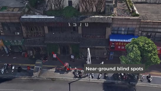
SLAM-Only Limitations
Rich details are well-preserved at street level, but:
- Coverage is slow and expensive for large areas
- No top-down perspective: rooftops, terrain, and elevated structures are missed
- Consistent geo-referencing across a large area is difficult to maintain
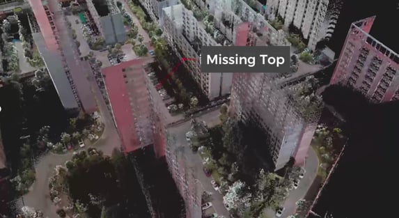
This is the reality of single-source 3D capture. Each platform, aerial or terrestrial, has blind spots that the other can fill. But combining them manually is time-consuming, error-prone, and often impractical for real-world projects.
The Solution: Air-Ground Fusion as an Integrated Approach
Air-Ground Fusion is more than a technique. It’s a comprehensive approach that seamlessly integrates:
- Aerial Data Capture: Drones equipped with high-resolution cameras or LiDAR sweep across the site from above, capturing rooftops, overall geometry, and areas inaccessible from the ground.
- Ground-Level Scanning: SLAM scanners like the Get3D R200 traverse the site at street level, capturing detailed facade geometry, interior spaces, and features hidden from aerial view.
- Intelligent Processing: Advanced software algorithms automatically align and fuse the datasets into a single, spatially consistent model with no manual stitching required.
- Quality Output Generation: The result is a complete digital model ready for various applications.
What Can You Achieve?
The fundamental principle underlying Air-Ground Fusion rests on the observation that aerial and terrestrial platforms capture fundamentally different perspectives of the same environment. This complementarity manifests in several dimensions:
- Geometric Complementarity: Aerial platforms capture top-down geometries and roof structures; terrestrial systems document vertical facades and interior spaces.
- Scale Complementarity: Drones provide site-wide context at regional scales; ground systems deliver localized detail at component-level resolution.
- Occlusion Complementarity: Aerial views capture areas hidden from ground-level sightlines; terrestrial scans document features obscured from above.
Related Articles
- How Does Get3D Power Air-Ground Fusion? — Get3D ecosystem: R200, 5-in-1 Camera, Mapper, Farmlite
- Technical Advantages of Air-Ground Fusion — Complete 3D models, multi-output formats
- Case Studies: Air-Ground Fusion — Real-world urban, heritage, stadium projects
- What is Large-Scale 3D City Modeling? — City-scale application of fusion technology
- What Is Content-Aware Technology? — AI-driven reconstruction pipeline
- What is 3D Model Lightweighting? — Compress and deploy fusion outputs
Source: Get3D Knowledge Center