What is 3D Gaussian Splatting?
Overview
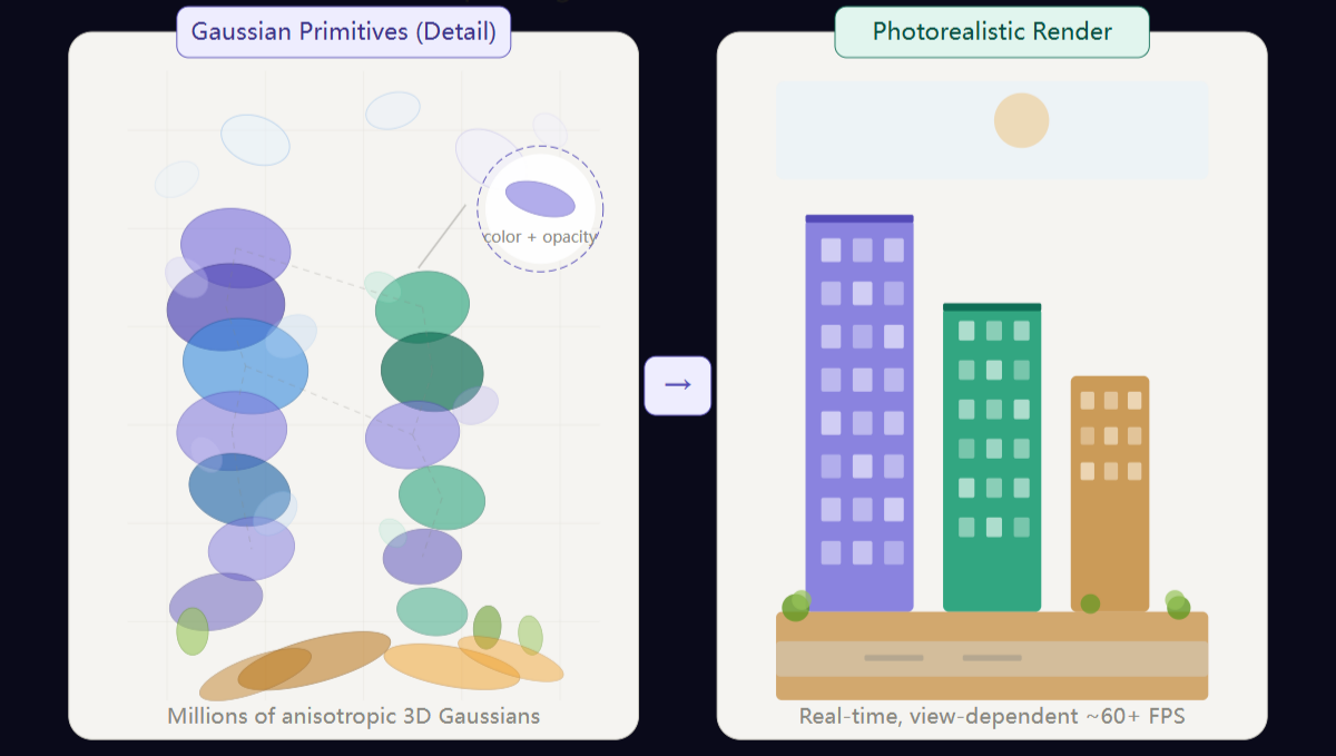
3D Gaussian Splatting (3DGS) represents a scene as millions of tiny, colored ellipsoidal “splats” floating in 3D space. Each splat carries position, color, opacity, and view-dependent appearance information. When rendered together — at real-time frame rates — they form a photorealistic scene indistinguishable from a photograph.
Unlike traditional mesh or point-cloud representations, 3DGS produces view-dependent renderings with detail fidelity that rivals — and often surpasses — classical photogrammetry outputs. The technique, introduced in a landmark 2023 paper by Kerbl et al., has quickly become one of the most active frontiers in computer vision research.
Its impact on GIS and photogrammetry is profound: for the first time, city-scale 3D scenes achieve cinematic quality with web-browser-level interactivity.
The Problem: Four Limitations of Classical 3D for GIS
1. Reality meshes are heavy and slow
- Storage overhead: A 10 km² urban reconstruction can consume 50–200 GB in OBJ/OSGB format
- Bandwidth bottleneck: Streaming meshes to field operators on mobile networks fails at anything beyond LOD 3
- Interaction lag: 5–15 FPS is typical for dense meshes in web viewers
2. Point clouds lack visual context
LiDAR point clouds remain the gold standard for measurement accuracy, but for communication — presenting to city planners, emergency responders, or non-technical stakeholders — a colored point cloud is illegible.
3. Photogrammetric meshes have inconsistent texturing
Shadows, moving objects, reflective surfaces, and thin structures create artifacts: stretched textures, ghosted geometry, or outright holes. Post-processing these artifacts can consume 40–60% of a production team’s time.
4. View-dependent effects cannot be captured
Traditional textured meshes bake a single “best” color per surface point — losing the visual cues (reflections, specular highlights, transparency) that make a scene feel real.
The 3D Gaussian Splatting Approach
| Limitation | 3DGS Approach | Practical Benefit |
|---|---|---|
| Heavy meshes | Anisotropic Gaussian primitives (1–10 million for city-scale) | Sub-second load times in web viewer |
| Point cloud illegibility | Gaussians render as overlapping semi-transparent ellipsoids | Looks like a photograph from any angle |
| Texturing artifacts | Each Gaussian encodes view-dependent spherical harmonics | No texture seams, no baking required |
| No view-dependent effects | Spherical harmonic coefficients per Gaussian | Glass, water, and metallic surfaces render correctly |
The training pipeline: given calibrated input images (what any photogrammetry survey already produces), a differentiable rasterizer optimizes Gaussian parameters through gradient descent — typically 10,000–30,000 iterations.
What Can You Achieve with 3DGS in GIS?
- Real-time photorealistic flythroughs of city-scale digital twins at 60+ FPS in a web browser
- Instant measurement and annotation directly on the 3DGS scene
- Seamless multi-source fusion: combine drone, satellite, and ground-level images into a single coherent 3DGS scene
- Training from existing photogrammetry datasets: no new hardware required
- Progressive streaming to mobile and edge devices
Result: Teams using 3DGS report 60–90% reduction in scene load times and 3–5x improvement in rendering frame rates compared to equivalent reality mesh implementations.
Related Articles
-
3DGS vs. Traditional Photogrammetry — When to choose 3DGS, and when to choose traditional photogrammetry
-
Can You Measure from a Gaussian Splat? — A precision decision framework for 3DGS deliverables
-
LOD Level of Detail Explained — Background to the LOD rendering issues addressed by 3DGS
-
Technical Advantages of Air-Ground Fusion — 3DGS as a fusion data output format
-
What is 3D Model Lightweighting? — The complementary relationship between 3DGS and traditional lightweighting
Source: Get3D Knowledge Center